
Topographical Land Surveys
Clear Records of Existing Land Levels
Get a Free Quote From Us Today!
We aim to get back to you in 24 hours.
At Topographical Land Surveys, we specialise in comprehensive site surveys tailored for construction and development projects across the UK. We create precise records of existing land levels and physical features to assist architects, engineers and project professionals. Using advanced surveying technology, our team delivers detailed data essential for informed planning and design.
Contact us today to discuss your project requirements.
Who Is Topographical Land Surveys?
At Topographical Land Surveys, we are experienced surveyors providing vital data for construction and development projects throughout the UK. We use state-of-the-art equipment to capture detailed measurements of land levels, boundaries, and surface features. Our services include using high-resolution LIDAR scanning, which delivers precise elevation data, and drone surveys for aerial views of expansive sites, offering a understanding of the terrain.
We provide detailed reports including 2D and 3D mapping, which architects and engineers find crucial in designing safe and efficient structures. Our team stays updated with the latest industry standards, complying with the RICS guidelines to ensure accuracy and reliability.
Projects can range from small residential developments to large-scale commercial sites, each benefiting from our accurate and efficient surveying process. For more information or to discuss your specific requirements, please contact us today.
What Services Does the company Topographical Land Surveys Provide?
We offer a full range of topographical site surveys designed to meet the specific needs of our clients, ensuring precision and compliance with industry standards. Our services include:
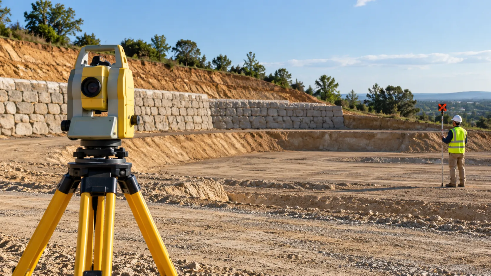
- Topographical Land Surveys: We employ advanced theodolites and GPS equipment to provide detailed mapping of site elevations, contours, and physical features. This data aids architects and engineers in designing suitable plans for new developments.
- Boundary Surveying: Establishing precise property lines to prevent boundary disputes. We adhere to the latest Land Registry standards to ensure our surveys are legally recognised.
- Construction Surveys: Providing measurements and data points vital for successful build planning. Our services include setting out buildings and roadways, and ensuring adherence to project specifications.
- Volume Calculations: Determining material quantities for excavation or fill requirements. Our accurate volumetric surveys help clients budget effectively and avoid costly overruns.
Each survey is tailored to provide accurate and dependable data, supporting informed decision-making for property developers and construction managers. Contact us today for a consultation.
When Is a Topographical Survey Needed?
A topographical survey is essential before beginning any construction or development project. At Topographical Land Surveys, we provide surveys that inform site planning and layout design, allowing for the assessment of drainage patterns and potential site challenges.
Our surveys typically precede infrastructure development or landscape changes.
These surveys are crucial for architectural design projects, ensuring accurate placement of buildings by mapping out natural and man-made features. We use technologies such as GPS and total stations for precise measurements of land contours, elevations, and boundaries.
We often work with civil engineers and architects to identify issues related to utility placements or road alignments. Conducting a survey can help mitigate risks associated with unseen underground utilities, saving time and costs during construction.
For detailed and accurate land insights, contact us today to discuss your project requirements.
Get a Free No Obligation Quotation Today
How Does Topographical Land Surveys Work?
We ensure a systematic approach in delivering accurate surveys by following these steps:
- Initial Consultation: We engage with clients to understand the specific project requirements, discuss timelines, and evaluate site conditions, including any constraints or unique features. This helps us tailor the survey to meet precise needs.
- Site Visit: During fieldwork, we deploy a range of surveying instruments, such as total stations, GPS units, and laser scanners, to collect precise measurements across the terrain. These instruments are vital for capturing both natural and man-made features, ensuring comprehensive data collection.
- Data Analysis: We use specialised software to process and analyse the gathered data, transforming it into detailed topographical maps and reports. This stage involves identifying elevation changes, plotting contour lines, and integrating GIS data for enhanced geographical context.
- Delivery: The final survey documents are delivered in digital formats like CAD or PDF, which are compatible with your project’s requirements. This ensures seamless integration into architectural plans or development applications.
Our method guarantees comprehensive insights for effective planning and decision-making. Feel free to contact us for further details on how we can assist your project.
Who Does Topographical Land Surveys Help?
Our services support a wide range of professionals, including architects, civil engineers, property developers and landscape architects. We provide essential data for designing and planning projects by using techniques such as total station theodolites and GPS surveying to ensure accuracy.
We assist in ensuring compliance with planning permissions and health and safety requirements by providing detailed topographical maps and terrain models. Many of our projects involve collaborating with public sector entities in urban planning, where we contribute to infrastructure development and expansion efforts.
Our surveys aid in flood risk assessments, environmental impact studies and site feasibility analyses, thus facilitating informed decision-making.
For commercial property managers, we help optimise land use and manage assets efficiently. Contact us to discuss how we can support your specific requirements.
How Quickly Can Topographical Land Surveys Respond?
We understand the importance of timely data in project planning. Our skilled team uses modern equipment such as total stations and GPS for precise measurements, ensuring accuracy across all terrains.
At Topographical Land Surveys, we typically complete and deliver survey reports within two to three weeks, depending on project complexity and size. For straightforward residential site surveys, our turnaround can be quicker, whereas larger commercial developments may require a more detailed approach, including additional time for data analysis and quality assurance.
Our adherence to industry standards, such as the RICS guidelines, guarantees the credibility and reliability of our findings. Contact us to schedule your survey and receive personalised time estimates.
How Does Topographical Land Surveys Ensure Quality and Compliance?
Our surveys adhere to the highest industry standards, ensuring accuracy and reliability. We incorporate the latest surveying technology and methodologies, such as total stations, GPS systems, and LiDAR, to meet or exceed UK regulatory requirements, including those set by RICS and the Ordnance Survey.
We perform detailed site analyses considering factors like terrain, land boundaries, and environmental impacts, and we carefully document all findings in comprehensive reports. Our team continuously updates its skills with specialised training and CPD courses, ensuring all work is compliant with current standards and legislation.
Furthermore, we prioritise consistent calibration of our equipment to maintain precision in our measurements. By doing so, we support clients ranging from architects planning a new development to civil engineers working on infrastructure projects.
Let us know how we can assist with your surveying needs.
Request a free quote
Why Choose Topographical Land Surveys?
Choosing Topographical Land Surveys means selecting a partner dedicated to precision and professionalism. We specialise in a range of surveying methods, such as GPS surveying and 3D laser scanning.
Whether you’re an architect, engineer, or property developer, we cater to diverse client needs.
- Expert Team: Our skilled professionals possess extensive industry experience, certified in the latest geospatial technologies and trained in Health and Safety regulations for onsite work.
- Advanced Technology: We use modern equipment like total stations and unmanned aerial vehicles (UAVs) to capture precise measurements, adhering to British Standard 5606 for topographical surveys.
- Fast Turnaround: Our streamlined process ensures timely project completion, typically within two to three days, delivering reliable and accurate results.
- Client-focused: We offer tailored survey solutions that meet the unique requirements of each project, including boundary surveys and volumetric calculations.
Trust Topographical Land Surveys for comprehensive and accurate surveying solutions that support your project from start to finish.
Frequently Asked Questions
What is a topographical survey?
A topographical survey involves creating detailed maps of land features and elevations. It is crucial for planning and development to understand a site’s physical properties.
How does a topographical survey benefit construction?
It provides vital data that informs design, assesses drainage and overcomes site challenges, such as elevation changes or obstructions.
What equipment does Topographical Land Surveys use?
We use surveying technology like robotic total stations and GPS systems to deliver accurate land assessments and mapping.
Get a Free Quote
Contact us today to discuss your project needs or to request a free, no-obligation quote.
speak with our team today
What People are Saying About Us
★★★★★
“Topographical Land Surveys arrived on the agreed day and kept us updated throughout our planning survey. A reliable company I would gladly recommend to others.”
Chloe Kaur
London
★★★★★
“Happy with the clear, accurate site drawing from Topographical Land Surveys. A solid job all round.”
Eleanor Pritchard
London
★★★★★
“Topographical Land Surveys made our sloping plot far simpler than we expected. The surveyor was friendly and patient, and every level was marked clearly for our architect.”
Eleanor Jennings
London
★★★★★
“Really delighted with Topographical Land Surveys. A brilliant company, and I would definitely use them again.”
Megan Whittle
London
Our Locations
We are proud to work nationally across the UK, allowing us to ensure we can provide services to you.
For a full list of counties we cover in the UK, see below.